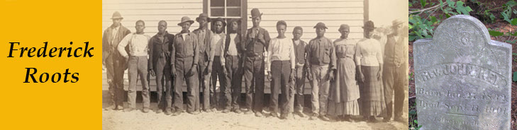

Frederick County Maps
The first two maps are ones that researchers may find helpful for locating individuals and communities in the mid to late 1800's. Experience has shown that, on the 1858 and 1873 maps, a location noted as a "colored" school, church, or cemetery is a good indication of an associated black community.
1858 Isaac Bond Map of Frederick
County
This map used to be downloadable from oldliner.com, but apparently
that site no longer exists?
An interactive version of the map, by district, is available at http://www.mdslavery.net/html/mapped_images/frd1.html,
through the Maryland State Archives (MSA). The MSA reference is "Frederick
County. Simon J. Martenet, Martenet's Atlas of Maryland, 1865, Huntingfield
Collection, MSA SC 1339-1-75." The map is actually the 1858 Isaac
Bond map. Simply replace the "1" in frd1 in the url with a
different number to get the map section for a different election district
of the county.
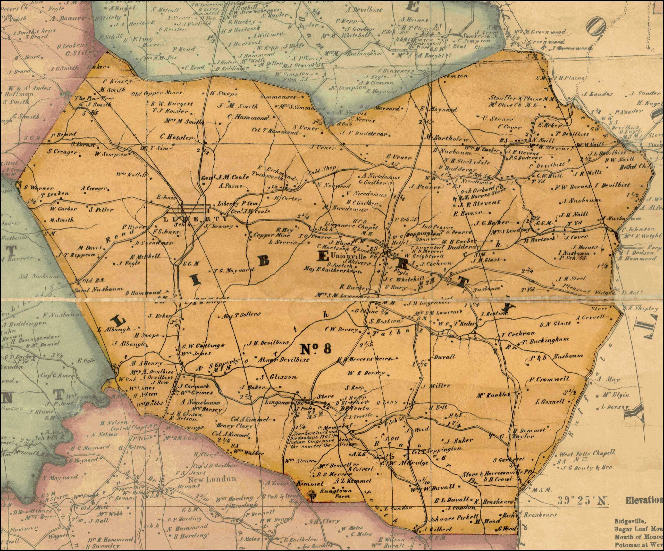
Liberty District Map 1858
Individual sector maps are available for:
Districts:
Buckeystown 1
Catoctin 6
Creagerstown 4
Emmitsburg 5
Frederick City 2
Hauvers 10
Jefferson 14
Jackson 16
Johnsville 17
Liberty 8
Mechanicstown 15
Middletown 3
Mount Pleasant 13
New Market 9
Petersville 12
Urbana 7
Woodsborough 11
Towns:
Berlin
Buckeystown
Burkittsville
Catoctin
Creagerstown
Emmitsburg
Frederick City
Graceham
Hauvers
Jefferson
Jackson
Johnsville
Knoxville and Weaverton
Lewistown
Liberty
Mechanicstown
Middletown
Mount Pleasant
Myersville
New London
New Market
Petersville
Point of Rocks
Sabillasville
Urbana
Walkersville
Woodsborough
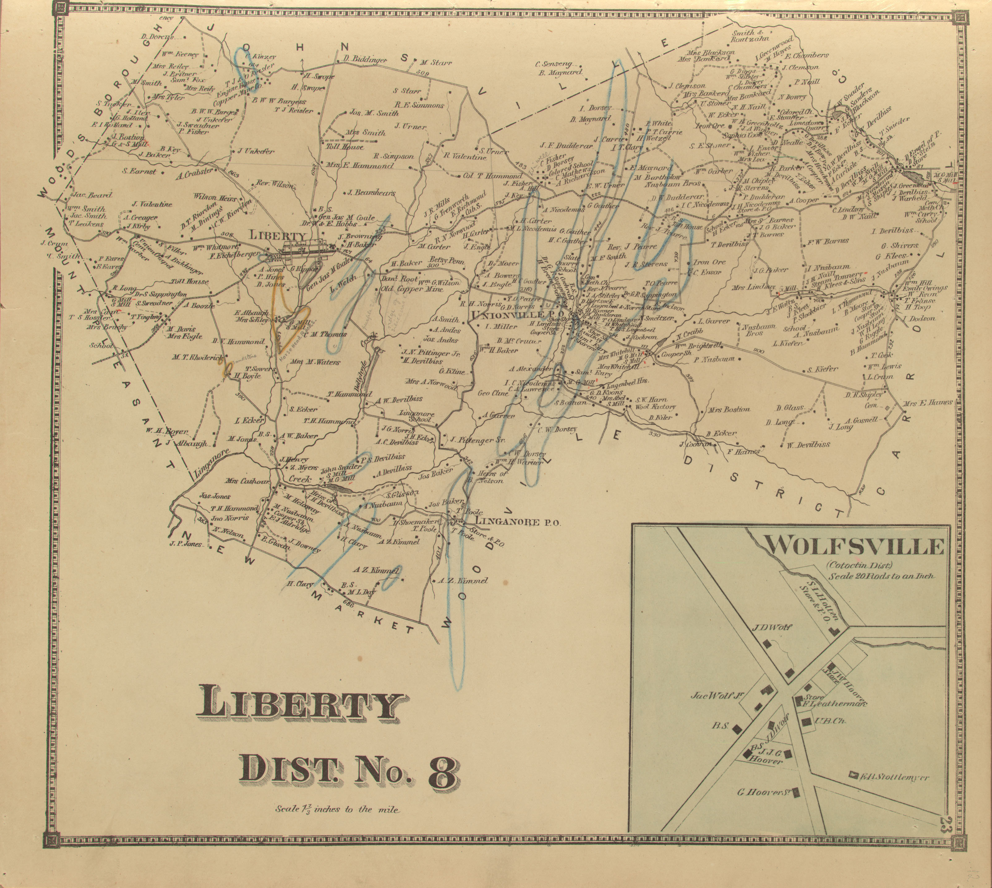
1873 Atlas of Frederick County
Maryland, D. J. Lake
This map book is currently out of print. If you come across a copy,
buy it! Currently the individual pages can be downloaded at: https://jscholarship.library.jhu.edu/handle/1774.2/34119.
As an example of the content, a portion of the Liberty District, No.
8 is available here for viewing:
Liberty District 8 - 1873 (1.4 MB) (Frederick County Atlas 1873); smaller B&W smaller map (240 KB)
Frederick County - 1873 (1.7 MB) (Frederick County Atlas 1873)
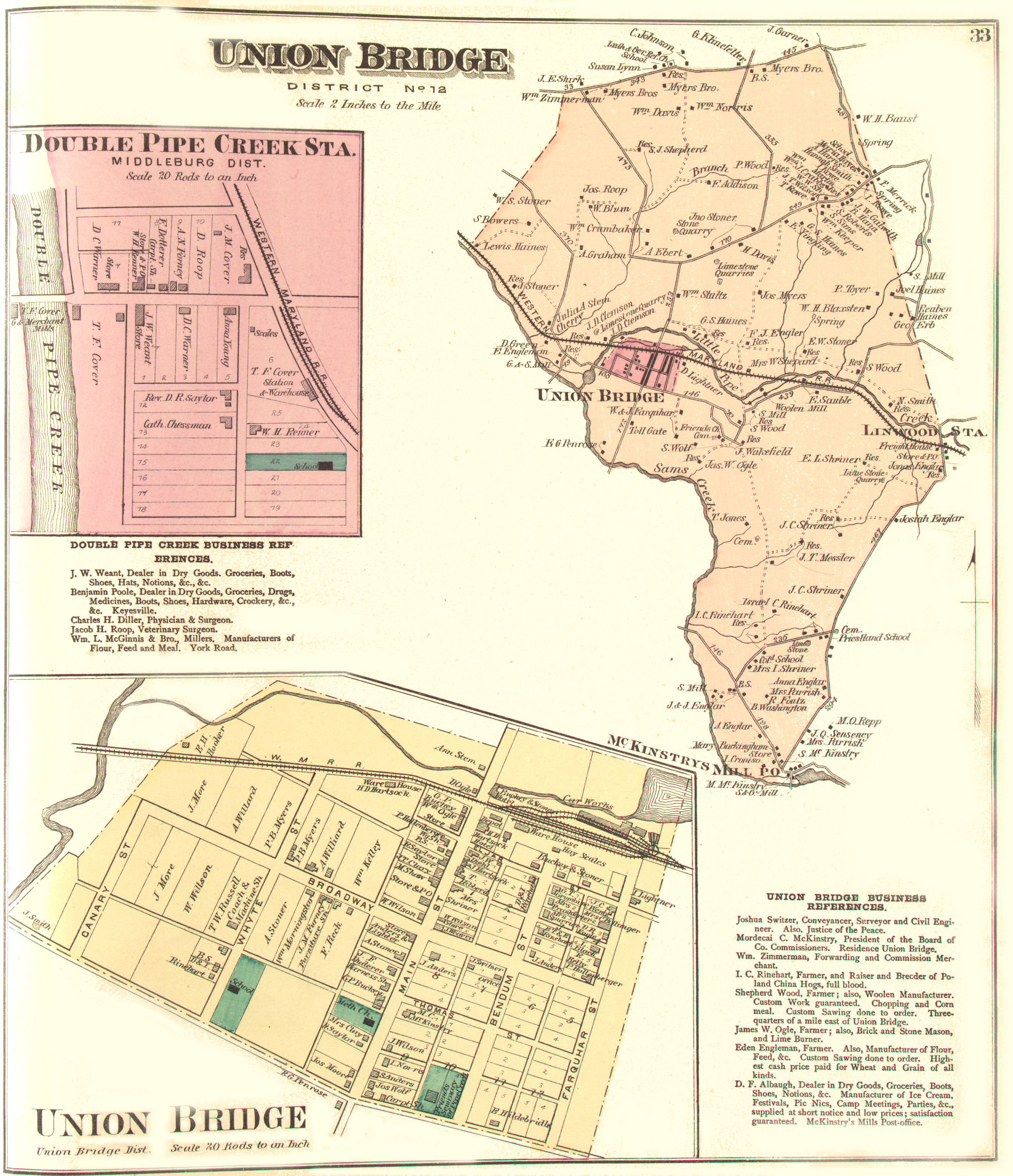
Union Bridge District 12 - 1877 (3.3 MB) (Carroll County Atlas 1877)
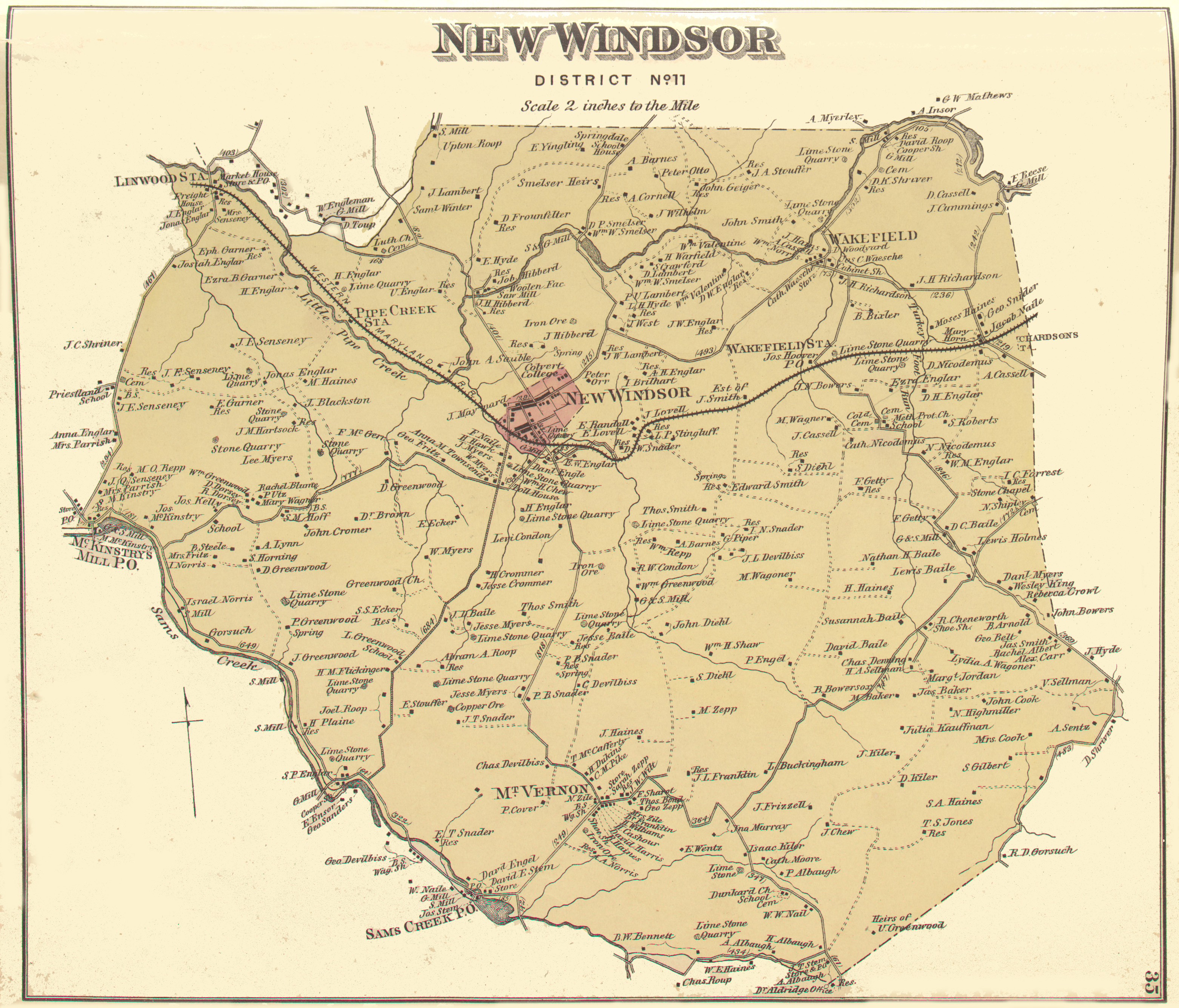
New Windsor District 11 - 1877 (3 MB) (Carroll County Atlas 1877)
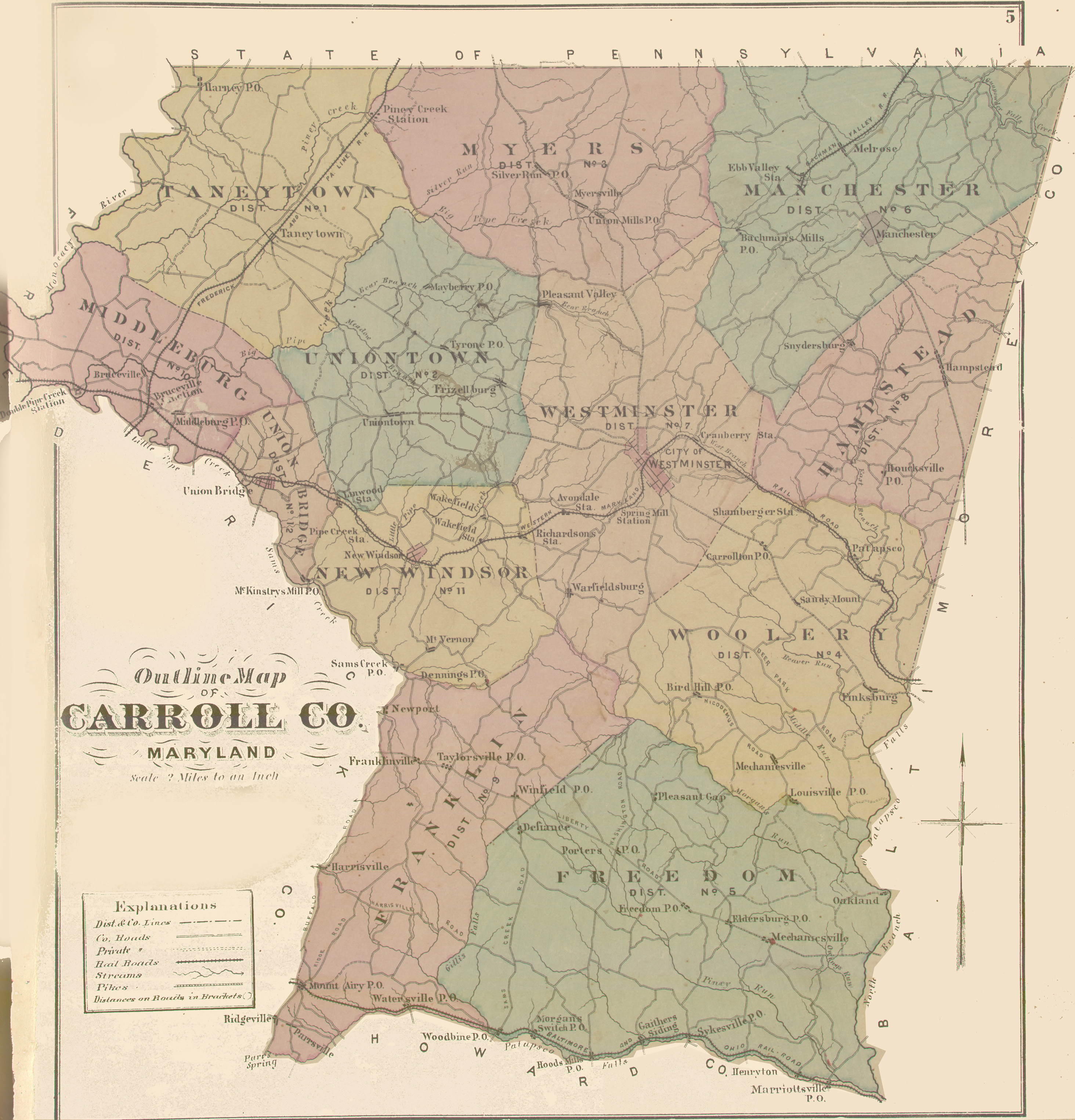
Carroll County - 1877 (2.3 MB) (Carroll County Atlas 1877)
Frederick Election Districts
Over time, the designation of the election districts of Frederick County
have changed. Below are three maps showing those changes.
Frederick Co. Districts - 1830 (Carroll
County not yet established - 1837)
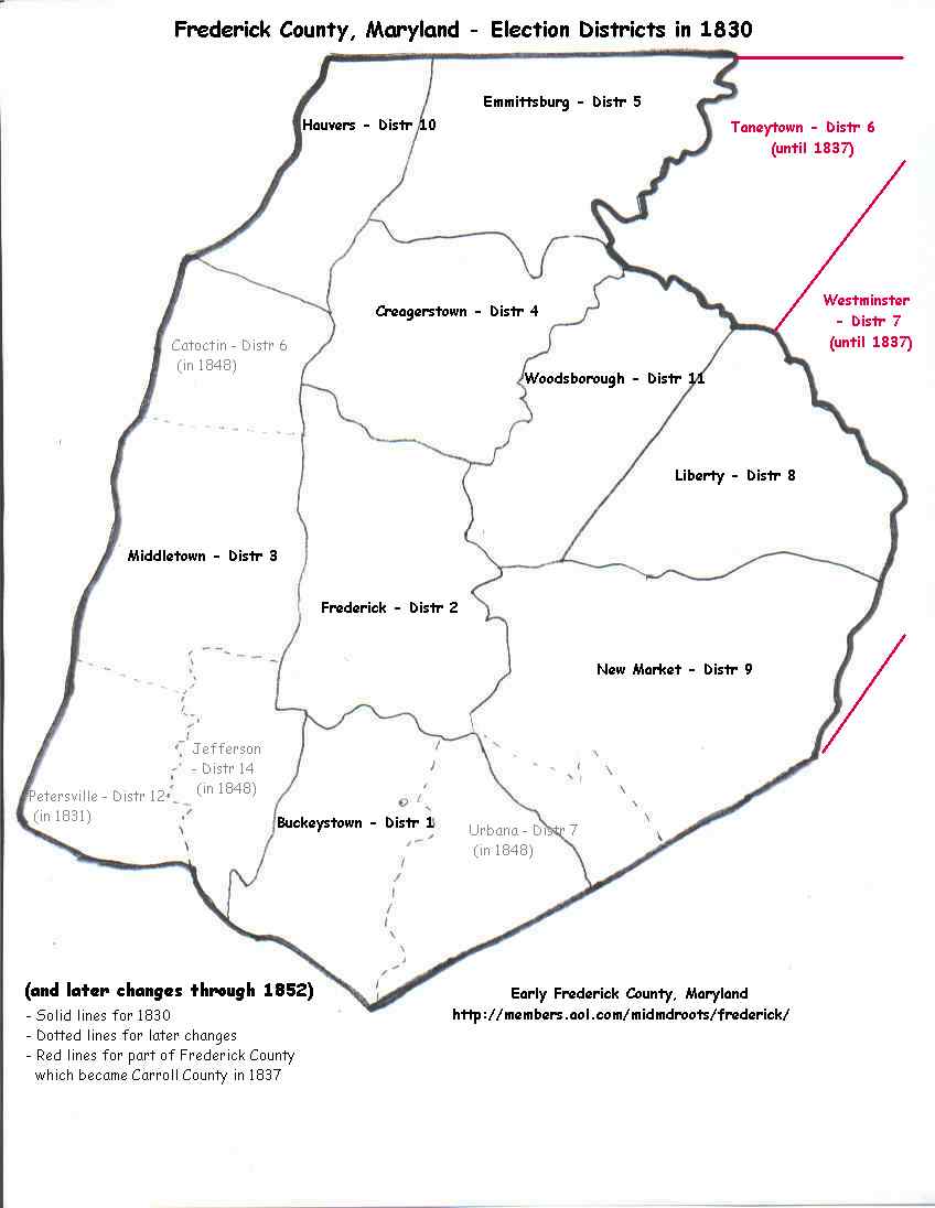
Frederick Co. Districts - 1854
Frederick Co. Districts - 1872
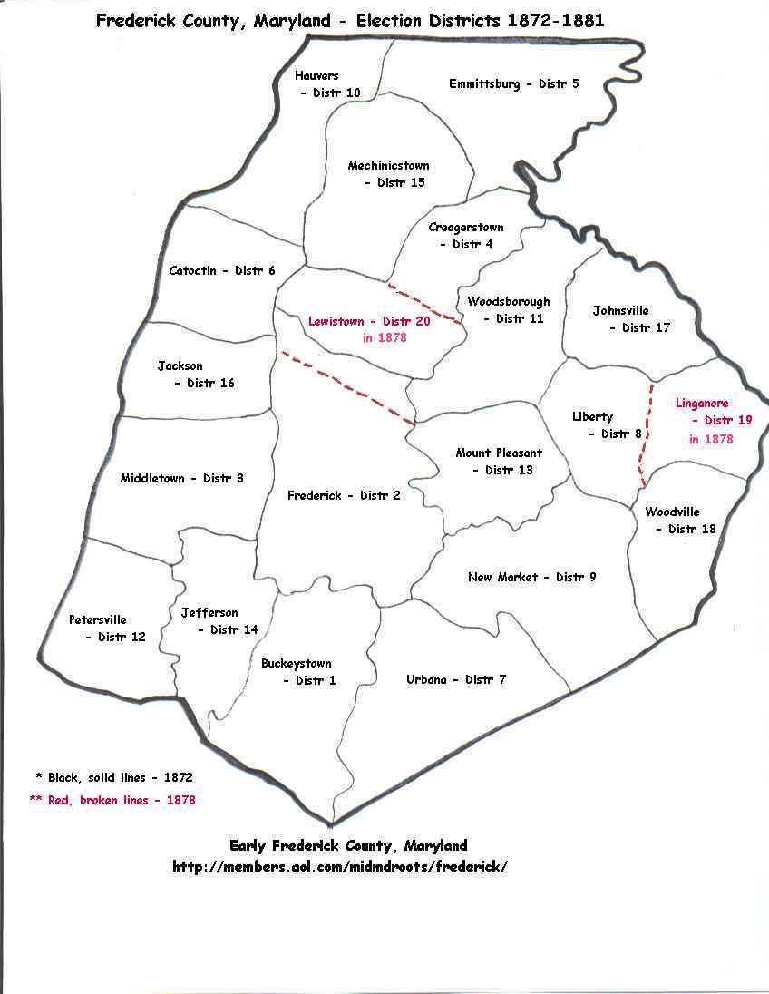